
Christmas Bird count maps
The circle for the Christmas Bird Count is centered in Cuyahoga Falls at the intersection of Broad and 2nd Street. This circle is broken into territories that have assigned leaders who are responsible for reporting the results of the count in their territory. As part of the count, there is also an associated Feeder Count conducted by people who reside within the circle boundaries.
The interactive map shown below is based on the territory boundaries that are currently being used. These are slightly different from the ones that were originally drawn by Bert Szabo (see colored pencil map below). The interactive map is a draft of the final map. Clicking on the binoculars in a territory will display information about that territory. You can expand this map or, for a larger map, click on the square in the upper right side of the map. You can find detailed information about each of the territories by clicking here.
The interactive map shown below is based on the territory boundaries that are currently being used. These are slightly different from the ones that were originally drawn by Bert Szabo (see colored pencil map below). The interactive map is a draft of the final map. Clicking on the binoculars in a territory will display information about that territory. You can expand this map or, for a larger map, click on the square in the upper right side of the map. You can find detailed information about each of the territories by clicking here.
circle map with Territories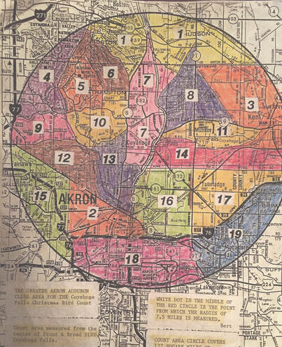
|
Circle map without territories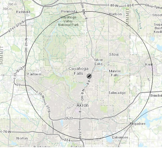
|